OUR Sister companies
|
|

|
Services
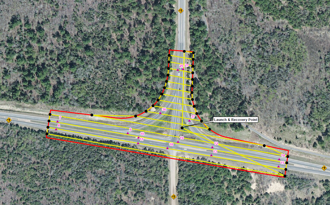
aerial SurveysPeregrine performs many common aerial survey tasks, some examples include: road and utility corridors, landfills, quarries, cultural resource, rail lines, and wetlands.
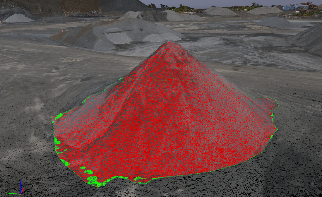
VOLUMETRICS

GIS
Peregrine provides advanced GIS analysis and consulting services for large engineering firms and various state agencies. Specifically, Peregrine specializes in advanced terrain processing, GIS development, and Enterprise GIS infrastructure consulting services.
|

3d models
Peregrine can deliver high resolution, high accuracy point clouds, TINs, 3D structures, contours, DTMs, and DSMs in suitable formats commonly used with CAD and GIS platforms.

Peregrine can deliver very high resolution, true orthophotos with stunning detail.
TRUE ORTHOPHOTOS
|